Using the CanberraUAV Imagery Set
Sources
CanberraUAV has collected a large number of images from the UAV Challenge.
These collections serve as a convenient source of image data to use with the cuav tools.
They can be found at:
- http://uav.anu.edu.au/OBC2016/CanberraUAV/
- http://uav.anu.edu.au/OBC2014/CanberraUAV/
- http://uav.anu.edu.au/OBC2012/CanberraUAV/
Note these are large downloads (~10Gb per imagery set).
The images themselves are in pgm format, which can be used directly with the Geosearch (geosearch.py) tool, or converted to jpg/png format via the PGM Converter (pgm_convert.py) tool.
Running Through a Geosearch
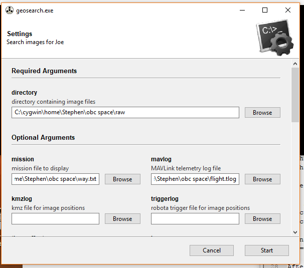
After downloading (for example) the 2016 Dataset, the geosearch program can be started with the following options:
| Argument | Value |
|---|---|
| files | <Raw subfolder> |
| --mavlog | <flight.tlog file> |
| --mission | <way.txt file> |
| --view | True |
Or as shown below:
After clicking Start, go to GEOSearch -> Start in the menu of the Mosiac window (see below image, start
button in red).
Then follow the instructions as per Geosearch (geosearch.py)